Log in
All resources
Create a design
14,157 Free Artworks of Bibliotheque Nationale
bibliothèque nationale de france
context files from gallica
maps of the islands of greece by marco boschini (1658)
marco boschini
illustrations of jean de la fontaine's fables by jean-baptiste oudry
engraving
a map of the british empire in america with the french and spanish settlements adjacent thereto
jean-baptiste oudry
maps by willem and johannes blaeu
bibliotheque nationale ms fr. 68
stonehenge in art
joan blaeu
a map of the british empire in america with the french and spanish settlements adjacent thereto
bibliothèque nationale de france
maps of enns by braun & hogenberg
bibliothèque nationale de france
territorium argentoratense (1652 map)
bibliothèque nationale de france
map of the strait of kerch by guillaume sanson
bibliothèque nationale de france
america, quarta pars orbis (quam plerunque novum orbem appellitand) primo detecta est anno 1492... - c. visscher, excudit - btv1b7200220t
bibliothèque nationale de france
maps of ancient italy by philipp clüver
bibliothèque nationale de france
america, quarta pars orbis (quam plerunque novum orbem appellitand) primo detecta est anno 1492... - c. visscher, excudit - btv1b7200220t
bibliothèque nationale de france
maps of formia by braun & hogenberg
bibliothèque nationale de france
description of the nobility of hainaut by braun & hogenberg
bibliothèque nationale de france
a map of the british empire in america with the french and spanish settlements adjacent thereto
bibliothèque nationale de france
maps of rügen by eilhard lubinus
bibliothèque nationale de france
chorographia britanniae (1741-1742)
bibliothèque nationale de france
maps of huy by braun & hogenberg
bibliothèque nationale de france
regnorum hispaniae nova descriptio (blaeu)
spain in the 1640s
pierre moullart-sanson
guillaume sanson
descriptio daciarum (17th-century map)
maps by pieter van der keere
regnorum hispaniae nova descriptio (blaeu)
spain in the 1640s
maps of haarlem by braun & hogenberg
bibliothèque nationale de france
a map of the british empire in america with the french and spanish settlements adjacent thereto
bibliothèque nationale de france
arnold van langren map of east africa
bibliothèque nationale de france
bibliothèque nationale de france
guillaume sanson
maps of the islands of greece by marco boschini (1658)
context files from gallica
maps of the islands of greece by marco boschini (1658)
old maps of delos
maps of st. gallen by braun & hogenberg
maps of konstanz by braun & hogenberg
america, quarta pars orbis (quam plerunque novum orbem appellitand) primo detecta est anno 1492... - c. visscher, excudit - btv1b7200220t
bibliothèque nationale de france
illustrations of jean de la fontaine's fables by jean-baptiste oudry
pierre chenu
17th-century maps of tartary
17th-century maps of siberia
illustrations of jean de la fontaine's fables by jean-baptiste oudry
juste chevillet
chorographia britanniae (1741-1742)
18th-century maps of sussex
illustrations of jean de la fontaine's fables by jean-baptiste oudry
jean ouvrier
illustrations of jean de la fontaine's fables by jean-baptiste oudry
laurent cars
maps by jean-baptiste bourguignon d'anville
old maps of roman hispania
illustrations of jean de la fontaine's fables by jean-baptiste oudry
rené gaillard
high renaissance
pirro ligorio
illustrations of jean de la fontaine's fables by jean-baptiste oudry
louis-simon lempereur
16th-century maps of crete
old maps of candia
illustrations of jean de la fontaine's fables by jean-baptiste oudry
martin marvie
illustrations of jean de la fontaine's fables by jean-baptiste oudry
pierre françois tardieu
1800s maps of the caribbean
charles picquet
maps by jean-baptiste bourguignon d'anville
18th-century maps of western europe
maps of peñón de vélez by braun & hogenberg
maps of tunis by braun & hogenberg
old maps of antiparos
old maps of paros
modernism
draner
old county maps of hertfordshire
maps by thomas kitchin
old maps of milos
maps facing east
theatrum historium ad annum christi quadringentesinum by guillaume delisle (1705)
1740s maps showing history
maps by alexis-hubert jaillot
sanson maps of the holy land
chodorlahomoris aelamitarum regis et confoederatorum regna ; seu aelamitarum imperium, antiquitati a gulielmo sanson restitutum, magnas repraesentans regiones a mari aegaeo ad indumusque fluvium quibus... - btv1b531793037
guillaume sanson
maps of the islands of greece by marco boschini (1658)
history of paros
maps of the islands of greece by marco boschini (1658)
context files from gallica
a map of the british empire in america with the french and spanish settlements adjacent thereto
1730s maps of the caribbean
texts about india
willem blaeu
maps from gallica
old maps of paris
context files from gallica
history of andros
maps of the islands of greece by marco boschini (1658)
history of patmos
1876 illustrations
academic art
maps of the islands of greece by marco boschini (1658)
history of naxos
old maps of seville
baroque
geological maps of england
william smith (geologist)
maps of the islands of greece by marco boschini (1658)
history of kalymnos
maps of peñón de vélez by braun & hogenberg
maps of tunis by braun & hogenberg
maps by willem and johannes blaeu
1663 maps of africa
maps of the islands of greece by marco boschini (1658)
context files from gallica
maps of the islands of greece by marco boschini (1658)
history of nisyros
modernism
draner
chorographia britanniae (1741-1742)
18th-century maps of wiltshire
maps of the islands of greece by marco boschini (1658)
history of anafi
magni ducatus lithuaniae
radziwiłł (surname)
maps of the islands of greece by marco boschini (1658)
history of milos
maps of bordeaux by braun & hogenberg
maps of nîmes by braun & hogenberg
maps of the islands of greece by marco boschini (1658)
history of kythnos
1690s maps of greece
maps from gallica
maps of meldorf by braun & hogenberg
maps of heide by braun & hogenberg
context files from gallica
history of amorgos
maps of saint paul's journeys
maps by thomas starling
laurens reael
willem blaeu
maps of the islands of greece by marco boschini (1658)
history of ios
1710s maps of the world
maps by edward wright
theatrum historium ad annum christi quadringentesinum by guillaume delisle (1705)
18th-century maps showing history
16th-century maps of crete
old maps of candia
maps by willem and johannes blaeu
beausse
limousin (province) in the 17th century
context files from gallica
context files from gallica
history of rügen
maps of the islands of greece by marco boschini (1658)
history of mykonos
maps of the islands of greece by marco boschini (1658)
history of tilos
maps of the islands of greece by marco boschini (1658)
context files from gallica
maps of the islands of greece by marco boschini (1658)
history of leros
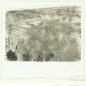
monotypes by edgar degas in the bibliothèque nationale de france
impressionism
prints by théodore géricault in the bibliothèque nationale de france
romanticism
prints by odilon redon in the bibliothèque nationale de france
symbolism
monotypes by edgar degas in the bibliothèque nationale de france
impressionism
grandes chroniques de france (jean fouquet)
renaissance
prints by honoré daumier
caricatures of france
antoine meyer, colmar
camille alfred pabst
bibliotheque nationale ms fr. 68
siege of antioch
bibliotheque nationale ms fr. 68
battle of dorylaeum (1097)
bibliotheque nationale ms fr. 68
baldwin ii of jerusalem
bibliotheque nationale ms fr. 68
siege of jerusalem (1187)
prints after nicolas poussin in the bibliothèque nationale de france
thomas patch
8501 - 8600 of 14,157
Next page
/ 142